Asking about scenic drives in Hawaiʻi may sound like a trick question, as driving just about anywhere is sure to treat you to beautiful scenery. But, some routes are more special than others.
On Maui, there are several scenic drives worth taking, both for the drive itself as well as the destinations they lead to, such as a remote town or the summit of a tall volcano.
The scenic drives described below will take you through some of the most beautiful landscapes on Maui, and also help you discover new things along the way.
Table of contents
Table of Contents
- Road to Hana
- Haleakala Summit via Haleakala Highway
- Kahekili Highway
- Upcountry Maui
- What about GPS drive guides?
Remember, while you may have a destination in mind, there is no rush! Take your time, drive slowly (and carefully), and enjoy the scenery. There are many thing to check out along the way. Stopping in small towns that you might otherwise pass will introduce you to the “real Hawaiʻi.”
1: Road to Hāna
Distance: 51 miles one-way from Kahului to Hāna
Where is it? Starting in Kahului, take the Hāna Highway east toward Hāna. From there, stay on the same road until you reach Hāna.
Good to know: There is also an alternative route that diverges from the classical route once you reach Hana colloquially called the “Road beyond Hana”. Now, instead of turning around, you continue through Hana and make a circle around Haleakalā, following the coastal road through the Kīpahulu District of Haleakalā National Park to the much-drier south shore, eventually arriving in the upcountry town of Kula.
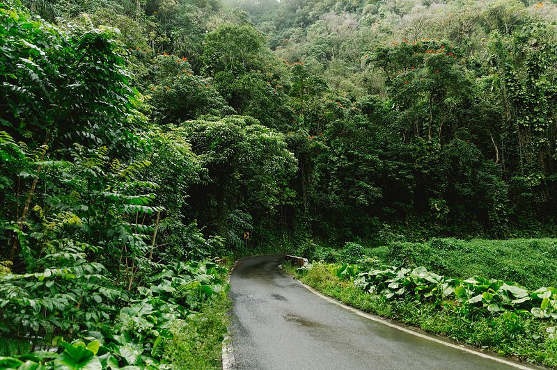
Our #1 tip for driving the Road to Hana is to “take it easy”, so you can take in the lush and tropical scenes along the road. Photo by Jordan McQueen on Unsplash
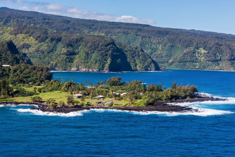
Why is it special? The Road to Hāna is the most famous drive in all of Hawaiʻi, and for good reason. Following a small, two-lane country road that hugs the ocean for most of it, you will embark on 620 turns and cross 59 one-lane bridges along Maui’s remote northeast coast. Comprised mostly of tropical rainforests, there are ample opportunities for stops, including some of the most stunning hiking trails on Maui, waterfalls, ocean views, and other points of interest.
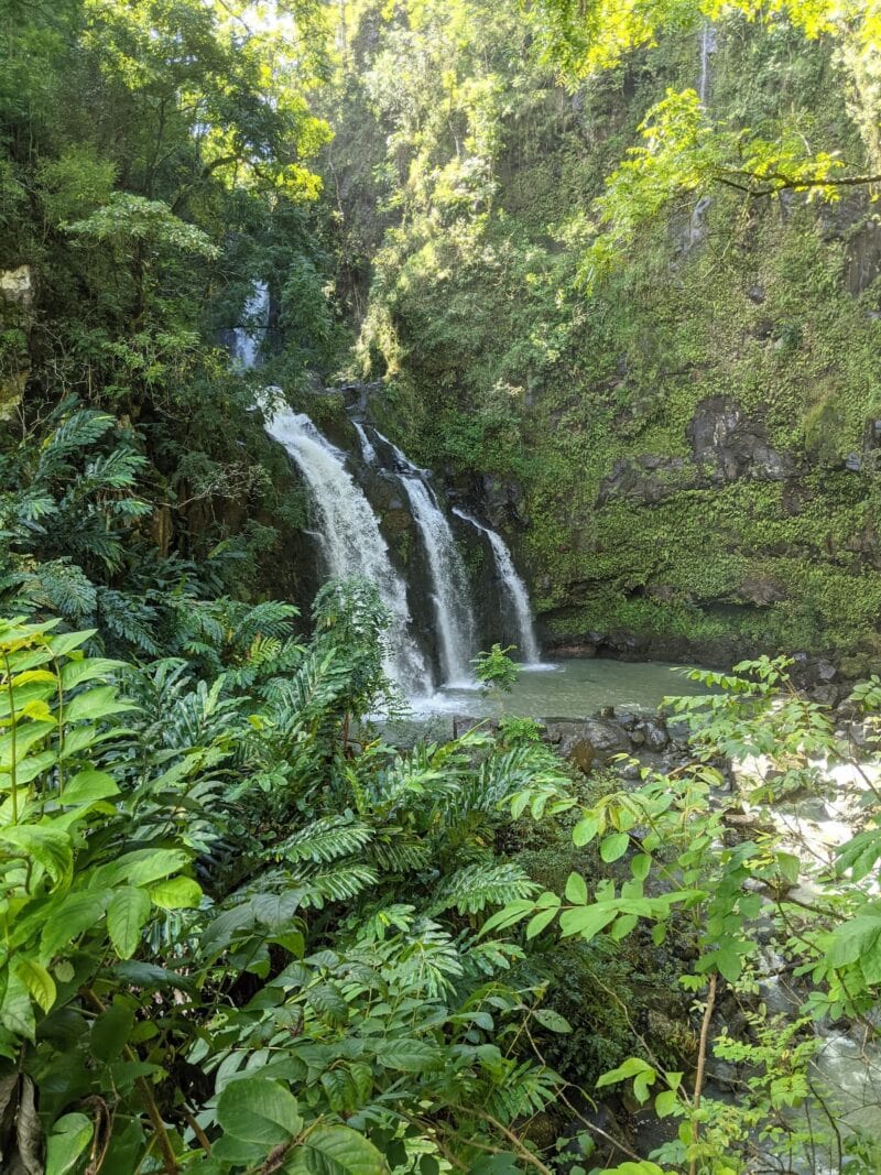
The Upper Waikani Falls are popular stop on the road to Hana because it is photogenic and situated like a drive-thru right off the road. Photo by Kevin Barasa on Unsplash
Recommended stops: The amount of things to do and the options for stops along the Road to Hāna is quite stunning. Some of the highlights are:
- Many Fruit stands
- Plenty of bridge crossings
- Twin Falls
- Kaumahina state wayside park
- Upper Waikani Falls (see picture below)
- Kaʻeleku cave
- And many more stops.
Recommended Tour: Because there are so many things to do and sights to see along the Road to Hana, planning the trip yourself can be cumbersome. Besides, the road is narrow and winding at times and whoever is driving your vehicle will not be able to enjoy the ride as much as everybody else. The following native Hawaiian family owned and operated tour company with a combined 30 years of professional tour guiding experience and generations of life experience from living in Hāna organized highly-appreciated (and reviewed) Road to Hana tours:
Explore the Road to Hāna, Hawaiian Style
Visit Maui's most stunning natural locations during this full-day small-group Road to Hana tour (12 guests max). Highlights include several swimming stops, panoramic views from Keanae peninsula, and glimpses of Haleakala volcano.
from:
$210
What is a suggested tour?Our suggested tours are hand-picked tours that receive consistent good reviews, give back to the community, and work hard to minimize their impact on the environment. Read more about these tours on our website.Dive in deeper: We recommend reading our guide to the Road to Hāna for the complete rundown on what to see and do, as well as advice for driving the infamous route.
2: Haleakalā Highway
Distance: 37 miles from Kahului to Haleakalā Summit and Visitors Center
Where is it? You can’t miss Haleakalā – it’s the largest volcanic mountain on Maui and makes up a majority of its land mass.
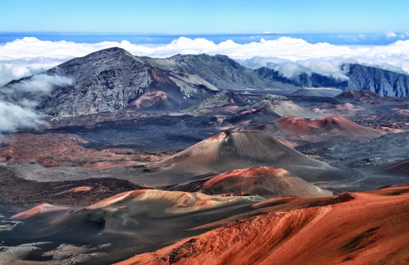
Why is it special? The Haleakalā Highway accesses Haleakalā’s summit in dramatic fashion, climbing from sea level up to 10,000 feet in elevation, ending at the National Park’s Visitor Center. Along the way, drivers are treated to sweeping views of Maui, including its farm-rich valley, coastal towns, beaches, ocean, and the West Maui Mountains. On clear days, you can see the offshore islands as well.
Another aspect that makes the drive special is seeing how the terrain and landscape changes along the way, beginning down in the busy, developed town of Kahului, ascending through the forests and farm land of Upcountry Maui, and then climbing the desolate slopes of Haleakalā in route to its volcanic crater – all in less than 40 miles.
The Haleakalā Highway was built in the 1930s in order to “bring the world to Maui.” You can read up on its history and see construction photos here.
Recommended stops on the Haleakalā highway
There are many things to check out along the way, some stops quick and others, depending on your interests, could make for longer side adventures. Here’s what we recommend:
Makawao
This historical town is the home of paniolo, or Hawaiian cowboy, culture. Its downtown has been refurbished here in modern times, now filled with art galleries, restaurants, and shops. You could do a quick drive through to check it out, or stay longer to have lunch.
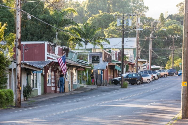
Along the streets of Makawoa (Upcountry Maui). Image credit: Hawaii Tourism Authority (HTA) / Tor Johnson
Kula
The next area you’ll encounter is Kula, an upcountry farm town. Located at about 2,500 feet, the views are just beginning. Enjoy this quaint town’s forests and small farms.
National Park Section
Once through Kula, you’ll enter the National Park Section of the Haleakalā Highway. You’ll notice an extreme transition of terrain, the green fields giving way to rocks and the endemic Haleakalā silversword. Pull offs and viewpoints will become common, and we recommend stopping at several, such as Leleiwi and Kalahaku, for photos and perspective. If you’d like to check out a hiking trial, there are several along the highway, including Hosmer’s Grove and Halemauʻu.
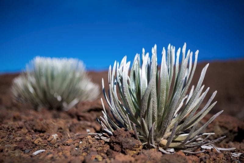
Close up of the rare hinahina (silversword) plants, on the slopes of Haleakala. Credit: Hawaii Tourism Authority (HTA) / Tor Johnson
Haleakalā Summit
Your destination is the summit, and once you arrive, there is much to explore. Check out the Visitors Center, view points, and, if prepared with day packs, food, and water, the Sliding Sands Trail, which heads out into the volcanic crater.
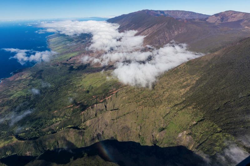
If you like the road less traveled, exploring the ‘backside’ of Haleakala is an adventure worth taking. Credit: Hawaii Tourism Authority (HTA) / Tor Johnson
3: Kahekili Highway
Distance: 37 miles from Kahului to Lāhainā
Where is it? This scenic drive explores the northwest coast of Maui, the mostly undeveloped coastline between Kahului/Wailuku and Lāhainā/Kaʻanapali.
Why is it special? Outside of Kapalua, there is little to no infrastructure along the northwest coast, offering visitors a natural experience. There are opportunities for hiking and coastal walking, as well as scenic locations with ocean views. Compared to the Road to Hāna and the Haleakalā Highway, Kahekili is much less visited.
Fair warning: Kahekili Highway isn’t really a “highway.” The road hugs the sea cliffs and is very narrow (often just one lane) with many blind curves and no guard rails, and some people consider it hazardous and one of the spookiest roads they have driven.
Recommended stops on the Kahekili Highway
We recommend starting with a cup of coffee in the budding town of Wailuku (Wailuku Coffee Company), then setting out on the Kahekili Highway. The road becomes very tight and winding before long, so drive with care and go slow.
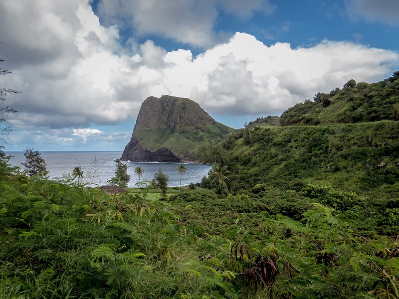
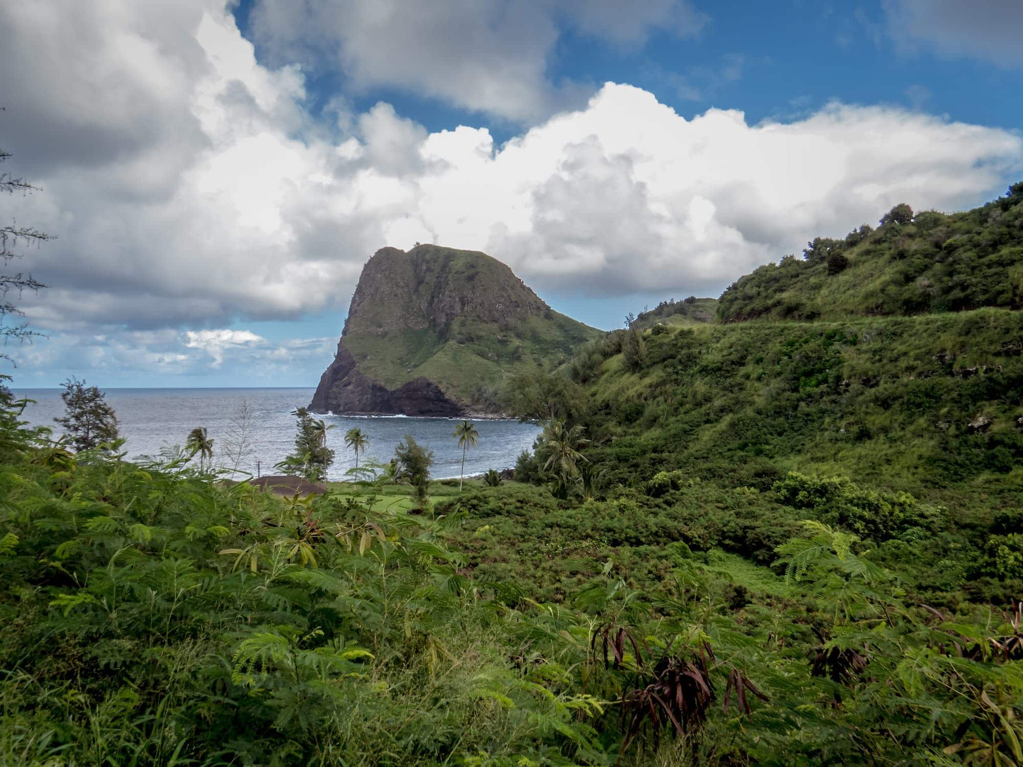
The 636-foot (194 m) high Kahakuloa Head (Pu’u Koa’e) is a scenic landmark on Kahekili Highway (Route 340). Credit: Jesse Hodge, source.
Enjoy the green hillsides until you reach Kahakuloa Bay (see illustration above), home to a small village and a rocky, walkable beach. This is a very scenic area, great for a stop and stroll. You will also find vendors and snack shops in this area, including banana bread, shave ice, coffee, and an art gallery.
The next stop is the Nakalele blowhole and lighthouse, accessible via easy walking paths. There is no shade in this area, so be sure to bring water, and watch out for sharp lava rock. Always view blowholes from a distance!
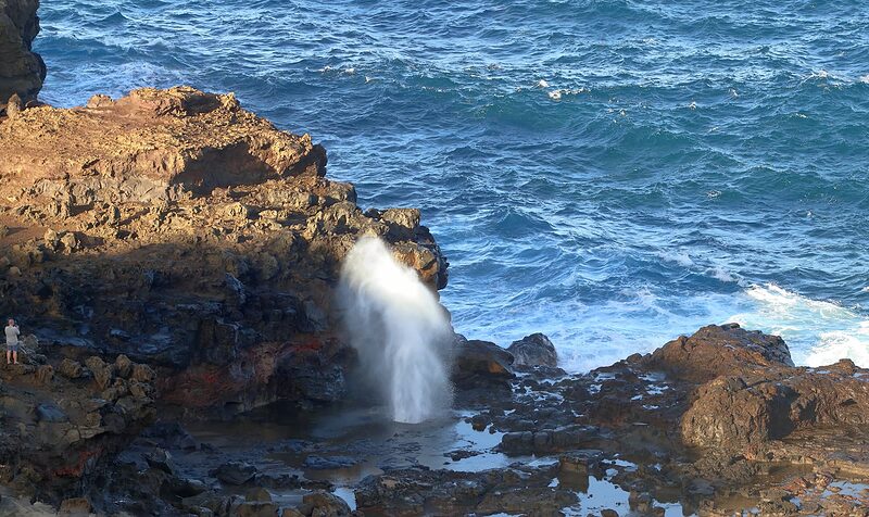
The Nakalele Blowhole on Maui. See the person in the left of the image for scale. Photo by Simon Hurry on Unsplash.
Take in the views along Honokohau Bay (not to be confused with Honokahau Bay, which you will see later in Kapalua) at the northern-most point of the island before reaching the more-developed yet stunningly beautiful Punalau, Honolua, and Kapalua areas. There are many hikes, beaches, and snorkeling opportunities in this area. From there, you will begin driving south and enter Kaʻanapali and Lāhainā.
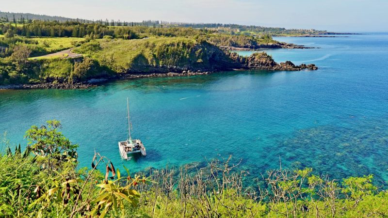
Snorkelers and a catamaran in Honolua Bay, one of the few sheltered bays to snorkel on Maui. Image credit: Edmund Garman, source.
Some other hikes to consider along the northwest coast are the Waiheʻe Ridge Trail, the ʻOhai Trail, and the Acid War Zone Trail (for more, see our Top Hikes on Maui).
Note on tide pools: There are many tide pools along the Kahekili Highway, and you will probably see many people swimming in them. We don’t recommend this. Many people are injured (and some even die, unfortunately) when big waves crash into the tide pools and drag swimmers along the rocks or out to sea. Even on days it looks calm, rouge waves can still cause problems. We recommend swimming only at lifeguarded beaches. Grab a seat and enjoy the view, but stay out of the water along this coast.
4: Upcountry Maui
Distance: 16 miles one way, but distance can vary based on your exact route.
Where is it? This route begins on the north shore in Pāʻia and passes through several small towns as it climbs into Upcountry Maui, ending in and around Kula.
Why is it special? When people think of Hawaiʻi, they always think of the coasts and the beaches. Here, we are treated to a different side of Hawaiʻi, one far away from the coast in the upcountry hillsides.
This is more of a meandering drive than a purposeful one; however, if you like driving on backroads and exploring rural areas, you’ll find this drive to be enjoyable.
Recommended stops on your way to Upcountry Maui
Start by picking up a coffee or snack in the coastal, hippie town of Pāʻia. From there, head north on the Hāna Highway and turn right onto Haiku Road. You will start to climb up from the coast and enter the lush, rural lands of Haiku. Families will like the Waterfall and Chocolate Tour at Kings Gardens.
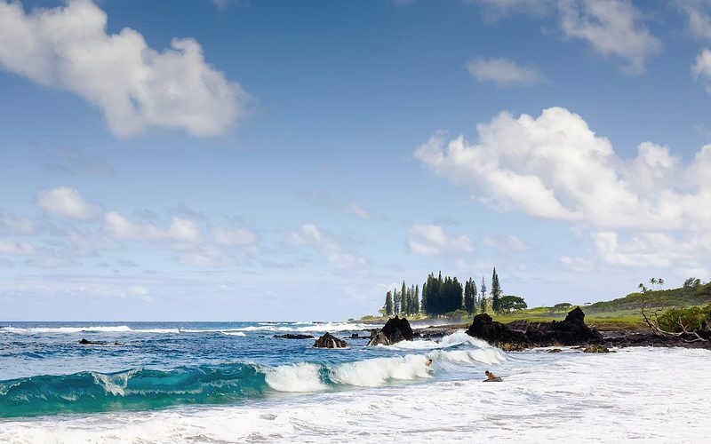
Pāʻia beach is a beautiful white sand beach on the North Shore of Maui. Photo by Luca Bravo on Unsplash
Next up is the cowboy town of Makawao, home to shops, art galleries, restaurants, and Hawaiian cowboy (paniolo) history. Nearby is the Hui Noʻeau Visual Arts Center, a community arts center that welcomes visitors to check out its exhibitions, art classes, studios, and curated grounds. From there, head into Kula and enjoy its beautiful views. Stop in to the Upcountry Farmer’s Market for fresh produce, or take a local farm tour, such as the Surfing Goat Dairy or Kula Lavender Farm, among others – check out the full list of farm tours on Maui, many of which are near Kula.
On the way back to Pāʻia, go through Haliʻimaile, home of Maui Gold Pineapple and its infamous plantation. Take a tour and sample some spirits made from pineapples at the Haliʻimaile Distillery.
Note: You could also combine this drive (or parts of it) with the Haleakalā Highway. Start in Pāʻia, cruise through Haiku, Makawao, and Kula, then pick up the Haleakalā Highway and head for the summit.
A Note about GPS Driver Guides
Nowadays, there are many virtual and audio tour guide apps that track your GPS location and provide context and guiding material about the sites you are passing. Some will also include recommended stops, hikes, and other nearby points of interest.
While we have not extensively reviewed every app out there, we have poked around quite a bit and found mixed reviews in regards to their effectiveness. Here are some things to know and think about when it comes to GPS Driver and Tour Guide Apps in Hawaiʻi:
- Many visitors love them. And why not? They point out interesting things, and give you backstories of places as you drive around. Plus, they are much cheaper than hiring a guide.
- Many local guides dislike them. Virtual guides take business away from real-life tour guides and locals who live in the destination. When a virtual guide is used, money is not going into the destination, and you miss out on the local perspective you can only get from a real-life guide.
- Many local residents heavily dislike them. Because the apps are usually not made in Hawaiʻi, they often recommend things that are out of date and/or illegal. For example, we know of one app that encourages folks to bypass a private property sign in order to access a hike, and many apps send people to dangerous areas, such as Queen’s Bath on Kauaʻi, where people die each and every year. If there’s one thing locals don’t like more than visitors who don’t follow the rules, it’s the apps and media that encourage them to do so. We don’t recommend going around telling locals that you’re exploring the island via virtual guides if you want to make friends.
- Real life people give better and more personalized recommendations. Local people can offer personalized recommendations based on their experience and your interests; apps regurgitate whatever was pre-programmed whenever it was made. Chat up locals and guides for their current recommendations, based on what’s happening on the island at that moment, including events, weather, time of year, crowds, etc.
- We don’t recommend them as a primary source. We understand how they can add context to a trip at an affordable price, so don’t feel bad about having it on while you drive around casually. However, we recommend using them in addition, not in place, of a real-life local guide when it comes to the deep exploration of a particular area. Local guides give you the best and most current information, and your business supports the local economy. If we all relied on apps, tourism would turn into nothing more than a robotic experience, and at that point, why travel? Use an app as a secondary source of info and to collect casual information, but always ensure its recommendations are legal and okay with the locals before following them. Trust us – you will remember your local guide long after you have deleted whatever app you are using.
