Hiking trails on Maui come in all shapes and sizes. From trails through bamboo forests and swimmable waterfall hikes to high-elevation jaunts through Haleakalā’s barren volcanic caldera, there is a trail for every occasion.
To help you find the right hike, we break down some of the island’s best below, with options for easy, intermediate, and advanced adventures that range from casual strolls to legitimate volcanic explorations.
Related guides: Most people coming to Hawaiʻi visit multiple islands to make the most of the long trip needed to get here. If this is you and you are into hiking, we highly recommend our hiking series for the other islands.
Hiking and safety tips
The hikes recommended in this article should be considered with care – think about your experience, abilities, and preparedness before attempting. Be respectful of local residents, avoid trespassing, and be sure you are parked legally. Bring snacks and plenty of water, wear proper footwear, and keep an eye on the weather, as conditions can change rapidly, especially in rainforests (aka, always bring a rain jacket). Don’t leave valuables in your car.
5 Easy Hikes
Looking for a light stroll through nature? Maui’s short hikes are still big on scenery.
- ʻIao Valley State Park (1 mile)
- Twin Falls Trail (2 miles)
- Nakalele Blowhole (1.5 miles)
- Waihou Spring Trail Loop (2.5 miles)
- Waikamoi Ridge Trail (1.5 miles)
‘Iao Valley State Park (1 mile)
Description: Known for its sharped-ridge, 1,200-foot “needle” rock formation, ʻIao Valley’s walking path winds its way up the volcanic hillsides, across a river, and through the jungle, with great valley views and tall, jagged peaks above. On a historical note, plaques tell the story of a bloody battle between Hawaiian chiefs that took place here in the valley in 1790. Go early for the best chance at clear skies and less crowds.
Directions: Park in the main lot for ʻIao Valley State Park. Head to the start of the walking path near the main entrance.
Reservations are required for out-of-state residents and can be made here. If you are traveling during high season it’s best to plan and reserve ahead. During low season same-day reservations are often possible.
Local grinds: Discover the downtown area of Wailuku, located just outside ʻIao Valley. Stop for a coffee at Wailuku Coffee Company, or if hungry, grab an empanada snack at the Empanada Lady.
Twin Falls Trail (2 miles)
Description: This out-and-back trail crosses rivers through the jungle, leading to Twin Falls, where you can take a dip. This hike is usually crowded, but it’s a nice jaunt for families, especially those new to waterfalls, because it is straightforward and beautiful.
Directions: The Twin Falls Trail is located along the Road to Hāna, at miler maker #2.1.
Local grinds: There’s a farm stand located at the trailhead. Alternatively, you could stop at another farm stand later down the road if you’re headed on the Road to Hāna.
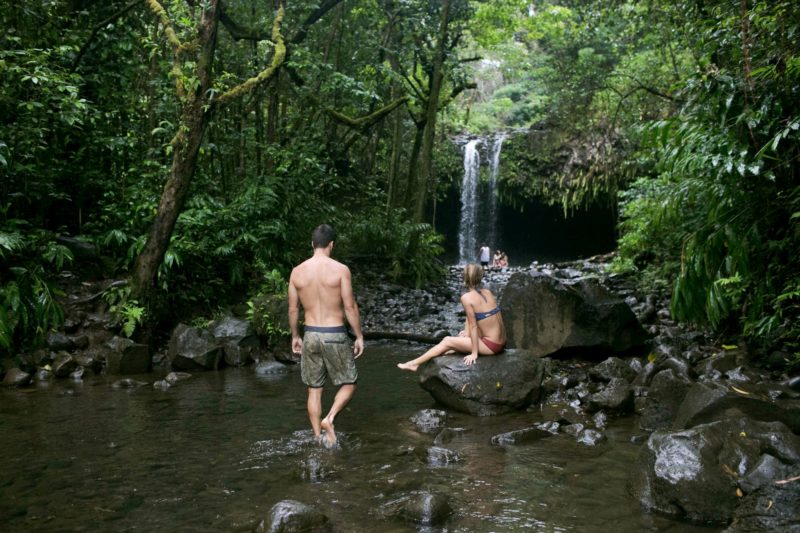
Make sure to bring a towel and wear swim gear when hiking to the Twin Falls. Credit: Hawaii Tourism Authority (HTA)
Nakalele Blowhole (1.5 miles)
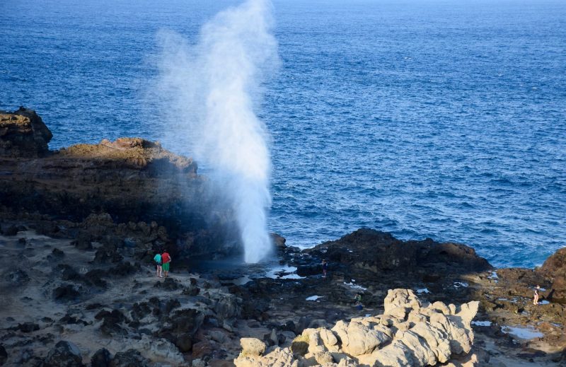
Description: This hike is short but intriguing, as it crosses over old, bare lava flows and ends at the sea, by a blowhole. The cliffs in this area are nicknamed “Acid War Zone” for their dramatic erosion and patterns. Note: Be sure to have closed-toed shoes in order to walk safely on the rocks. Be very mindful around the blowhole. Do not get too close and watch for incoming waves. People have died from being sucked into the blowhole, so please observe from a safe distance.
Directions: Follow directions for the Acid War Zone trail.
Local grinds: There are two farm stands just south of the Acid War Zone trailhead along the highway.
Waihou Spring Trail Loop (2.5 miles)
Description: This loop trail takes you through an upcountry forest at 4,000 feet above sea level, showcasing a mix of cypress, eucalyptus, and koa, as well as a small springs. While it still gets its fair share of weather, it’s a different environment than the coastal rainforests, with thick-trunked, hardwood trees packed tightly together. The area is part of a forest restoration effort.
Directions: You can find the trailhead near the upcountry town of Makawao.
Local grinds: Pop down into the town of Makawao, where you’ll find an array of restaurants, cafes, and coffee shops to choose from, like the Makawao Garden Cafe.
Waikamoi Ridge Trail (1.5 miles)
Description: Two short trails – one a small loop, another a quick out and back – show off the beauty of the Waikamoi Ridge. The trails take you through rainforest terrain as well as a small bamboo forest. For families just getting acquainted with the rainforest, this is a nice first trail, and a beautiful, quick jaunt/leg-stretch along the Road to Hana. Note that the trail can be muddy, so best to bring a towel or two.
Directions: Waikamoi Ridge Trail is located at mile maker #9.5 along the Road to Hāna. There is a parking lot at the trailhead.
Local grinds: There are several fruit and farm stands along the Road to Hāna. We suggest stopping at one down the road.
5 Intermediate Hikes
If you’re looking for a more substantial day hike on Maui, try one of these intermediate trails.
- Pīpīwai Trail (4 miles)
- Polipoli Trail System (3.5 miles)
- Lāhainā Pali Trail (5-10 miles)
- Waiʻānapanapa State Park Coastal Trail (3 miles)
- Waiheʻe Ridge Trail (5 miles)
Pīpīwai Trail (4 miles)
Description: The Pīpīwai Trail is known for its huge bamboo forest and ends at the 200-foot Makahiku Falls. It is a spectacular hike, but does get quite crowded. Consider camping at Kīpahulu and doing this hike first thing in the morning, before the day trippers arrive, to have it all to yourself.
Directions: The Pīpīwai Trail is located in the Kīpahulu section of Haleakalā National Park, 10 miles south of Hāna.
Local grinds: The best food options will be in Hāna, ten miles north along the highway.
Polipoli Trail System (3.5 miles)
Description: There are several trails in this area that, together, add up to a bigger loop: the Polipoli, Redwood, Plum and Haleakalā Ridge trails. The area, located at 6,400 feet above sea level, offers a look at Maui’s redwood, pine, cedars, and cypress forests with views looking out over the central valley of Maui.
Directions: The Polipoli Spring State Recreation Area is located near the town of Kula in upcountry Maui.
Local grinds: Check out a restaurant in Kula, like Kula Sandalwoods or Kula Lodge.
Lāhainā Pali Trail (5-10 miles)
Description: The Lāhainā Pali Trail climbs the western mountains and offers spectacular views looking across the valley at Haleakalā, as well as of the ocean and the nearby offshore islands. This trail includes a fair amount of climbing and elevation gain in order to achieve those views, however – it gains about 1,600 feet in 2.5 miles – and can be very hot and dry. The history here is that it was the path once used by Hawaiians to get from Wailuku to Lāhainā.
Directions: This hike can be started at one of two places: In the east from Maalaea, or the west just before Ukumehame Beach State Park.
Local grinds: After this climb, you’ll want to stop for a beer in Lāhainā at the Koholā Brewery.
Waiʻānapanapa State Park Coastal Trail (3 miles)
Description: The Waiʻānapanapa Coastal Trail was part of the “King’s Highway,” an ancient trail running 138 miles that once connected all the different land divisions of the island. Parts of it have been restored and preserved, and on this hike, you can see the smooth stepping stones amongst the otherwise rough, volcanic terrain. This trail explores this rugged coastline, juxtaposing the black volcanic landscape against the green, lush foliage and the blue of the ocean.
Directions: Waiʻānapanapa Coastal Trail is in Waiʻānapanapa State Park, located out east near Hana. There’s a black sand beach here, and advanced reservations for parking are now required. There are options for both tent and cabin camping.
Local grinds: Food options are available in the town of Hana 3 miles south, such as Hāna Ranch, as well as a variety of food trucks.
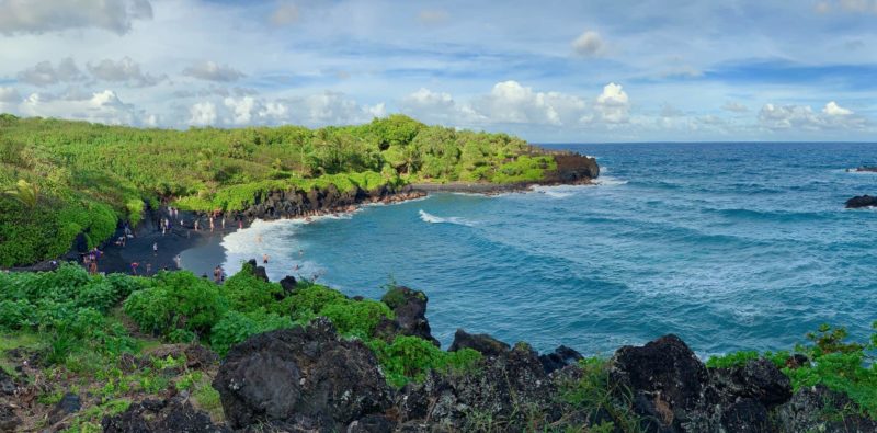
The volcanic black sand beach in the Wai’anapanapa State Park black sand beach. Image credit: Anita Gould, source.
Waiheʻe Ridge Trail (5 miles)
Description: The Waiheʻe Ridge Trail climbs a dry ridge and offers panoramic views of the ocean and Maui’s rural northwest coast. The hike is not that long – just 2.5 miles one way – but the climb is steep, about 1,500 vertical feet. Though the climb makes it difficult, the trail is well traveled and straightforward, making it a good push-yourself option for intermediate hikers. You’ll pass through pastures and forests, catch a view of Makamakaole Falls, and eventually have unabated views of the ocean as you climb.
Directions: This trail is located on the mostly-undeveloped northwest coast of Maui, about 10 miles from Kahului.
Local grinds: Head back to Wailuku or Kahului after the hike. Perhaps try a poke bowl from Tamura’s.
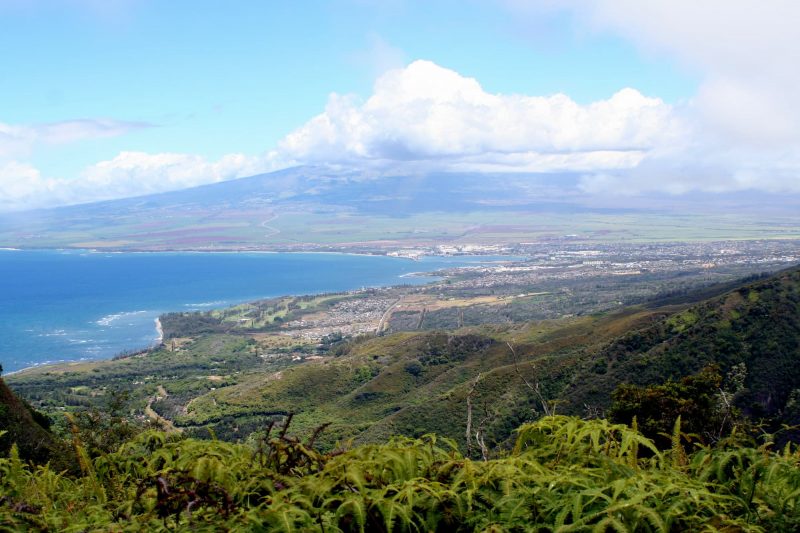
Haleakala from Waihee Ridge Trail. Image credit: Cassi Gurell, source.
5 Difficult (but rewarding!) Hikes
If you’re looking for a hike that’s a challenge and a true adventure, try one of these advanced trails.
- Sliding Sands Trail (11 miles)
- Hoapili Trail (5.5 miles)
- Halemauʻu Trail (10 miles)
- Mahana Ridge Trail (10 miles)
- Kaupo Gap (16-17 miles)
Sliding Sands Trail (11 miles)
Description: This 10-mile trail takes you through Haleakalā’s barren caldera, past old cinder cones with various colors of white, orange, brown, and red. Considered an “alpine desert hike,” you’ll pass very little plant life, save for the endemic Halekakalā silversword. Look for old volcanic “pits” in addition to the cinder cones. This trail is a part of a network of other trails that explore the crater.
Directions: The Sliding Sands Trail leaves from the main parking lot at the top of Haleakalā in the summit area of Haleakalā National Park.
Local grinds: Stop in the upcountry towns of Makawao or Kula on the way back from the Haleakalā Crater.
Hoapili Trail (5.5 miles)
Description: Another part of the aforementioned King’s Highway, the Hoapili Trail runs from La Perouse Bay southeast into the barren volcanic landscape that hugs the undeveloped, wild coastline. Bring plenty of water, as the hike is super exposed (no shade) and it can get quite hot and dry in this area. The terrain is terse, with sharp lava rocks, so caution and closed-toed shoes are a must. There are, however, places to cool down. Keawanaku Beach is about a mile into the hike and reached via a short side trail. There will be other small beaches along the way for you to check out as well.
Directions: Follow Makena Road southeast past Wailea until the road ends at La Perouse Bay.
Local grinds: Bring plenty of water and snacks on the hike. Stop in at Maui Brewing in Kīhei for a beer on the way home.
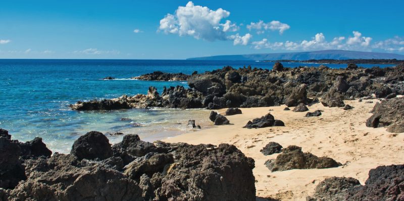
Before you set out, remember that there is no shade and the trail traverses jagged ‘a‘a lava that’s so sharp you’ll want proper hiking boots. Image credit: Kirt Edblom, source.
Halemauʻu Trail (10 miles)
Description: The Halemauʻu Trail takes you to the floor of the Haleakalā Crater, dropping nearly 1,000 vertical feet, which you need to climb back up on the way out. That aspect, along with its length, pushes this hike from intermediate to difficult. You’ll want to be prepared with plenty of water and snacks, as exposure is high on this hike.
Directions: The trail is located inside Haleakalā National Park. The trailhead is located along the Haleakalā Highway before you reach the main summit area and parking lot.
Local grinds: The nearest eateries are in the upcountry town of Kula on the way to the Haleakalā summit.
Mahana Ridge Trail (10 miles)
Description: Looking for a tough climb with ocean views? The Mahana Ridge Trail climbs 2,000 feet through native Hawaiian forests, ending at the Maunalei Arboretum. There was once a shuttle that could take you back to Kapalua from there, but that no longer runs, so be prepared to make the longer, round-trip hike. Most of the land you traverse was old ranch and pineapple land, but you’ll see today it’s found new life. This trail is not super busy, so expect to find some solitude.
Directions: Drive north through Lāhainā into Kapalua. You’ll find the trailhead at Fleming Park.
Local grinds: After the hike, take a dip in Honokahua Bay. Refuel at one of the restaurants there in Kapalua, like the oceanfront Burger Shack, or head south into Lāhainā for more options.
Kaupo Gap (16-17 miles)
Description: The Kaupo Gap is a legendary, adventurous endeavor on Maui. The trail runs between the summit of Haleakalā and the area of Kaupo on the remote, eastern backside of the National Park. It can be hiked in either direction – from the summit down to sea level, or from sea level up to the summit. Considering the total elevation change approaches 10,000 feet – that’s not a misprint – most people who attempt this trail do it from summit to sea. In either case, a car needs to be staged or a pickup arranged, and the trail, since it is lightly trafficked, is often overgrown in areas. This is the ultimate expert trail on Maui and should not be attempted alone or approached lightly.
Directions: Start in either Kaupo or at the summit of Haleakala. More specific directions to the trailheads can be found here.
Local grinds: This is one of the most remote hikes on the island, so you’ll want to bring all your own rations.
